Geocaches for GIS Day

GISDay_logo.png

In celebration of this year's GIS Day (Wednesday November 14th, 2012) the Bermuda Government's GIS Committee and the Department of Conservation Services are launching a series of GIS themedgeocaches as part of a real-world treasure hunting game. We challenge you to get out there and try to find them!

Held each year on the Wednesday of National Geographic Society's Geography Awareness Week (Nov 12-17), Geographic Information Systems (GIS) Day serves to make people aware of GIS technology and the important contributions it is making in the fields of science, technology, information and the humanities. This global event is a reflection of the enthusiasm and commitment of individual GIS users everywhere.

With the help of Bermuda Island Geocachers founder Darlene Fortin, we have hidden a series of caches, each with a particular GIS related theme. Find the cache, write in the log book and take a GIS Day bracelet!

geocache1c.jpg

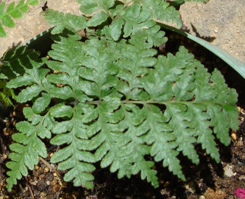
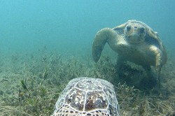
Example of one of the hidden geocaches

What is a geocache?

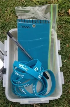
Geocaching is a real-world, outdoor treasure hunting game where participants use a GPS enabled device to hide and seek containers, called 'geocaches' or 'caches'. A typical cache is a small waterproof container with a logbook, where geocachers can put their name, the date and any other information they wish to share about their experience finding the cache. This is a great outdoor activity for both kids and adults. If you have a sense of adventure, this is the game for you!

What is GIS?

A Geographic Information System (GIS) is an innovative technology using geography to bring a number of benefits to our community. This computer based technology enables the collection, storage, analysis and visualization of geographic information. It is used throughout the world to solve problems related to environment, health care, land use, business efficiency, education and public safety. The ability to see geographic features on a map gives users a better understanding of a particular location, enabling planners, analysts, and others to make informed decisions. 

The GIS Committee is a team of representatives from multiple government departments and private companies dedicated to the development of GIS technologies in Bermuda. They encourage the development and use of quality geospatial information resources, coordinate GIS activities to avoid duplication of effort, and provide GIS advice and implementation assistance, for the benefit of the Government and the people of Bermuda.

Anyone and everyone is invited to take part in this outdoor adventure. The coordinates to our well hidden geocaches are listed at the official geocaching website (www.geocaching.com). Simply log onto the site, load the coordinates into your GPS device or smart phone and begin your search. There is no end date to this game (except for when you've found them all!). These caches will be out there for as long as we maintain them.

How to play

Step 1: Go to www.geocaching.com

Step 2: Create an account for FREE

Step 3: Enter 'Bermuda' into the search bar

Step 4: Find the GIS series by ConservationBda

Step 5: Click on the link to get the coordinates and read the description

Step 6: Load the coordinates into your GPS enabled device or smart phone (find an app for your phone at www.geocaching.com/live/)

Step 6: Get out there and have FUN!

geocacheopensa.jpg

Contents of the geocaches

Within the description for each cache you will find some information about how GIS is used in Bermuda. The GIS Committee hopes you will find this information interesting and gain an appreciation for the role this important technology plays in Bermuda.

You will also find a GIS Day bracelet in each cache! Please take one as a token of our appreciation for your participation and wear it proudly!

Need a GPS device?

Contact Karl Outerbridge at Out of the Box Thinking. Call 333-2601 or email info@otbt.bm. Check out his website at otbt.bm.

For more information on:

Questions?

Contact Mandy Shailer, GIS Mapping Analyst at the Department of Conservation Services

Phone: 299-2329 ex 2139

Email: mlshailer@gov.bm

2012 Bermuda International Shipwreck Conference

Interested in shipwrecks? Here is your opportunity to learn more.


The Department of Conservation Services, Government of Bermuda and the Historic Wrecks Authority are pleased to present the 2012 Bermuda International Shipwreck Conference to be held at the Bermuda Underwater Exploration Institute, East Broadway on the 3rd of November, from 9am till 5pm.


Topics

  • Historic Wrecks Authority - Role and Responsibilities
  • The Act - Legislation and Policy
  • Preparing an Environmental Impract Assessment for Site Investigation
  • GPS Marine Survey Techniques
  • Citizen Science
  • 'Baltic Shipwreck Archaeology: New discoveries-new opportunities-new strategies'
  • The Scarborough Bay Wrecks
  • Bermuda Shipwrecks
  • Marie Celesta
  • Why shipwrecks are relevant
  • Engaging Divers in Archeology


Speakers


Mr. Harold Conyers, Chair, Historic Wrecks Authority

Dr. Philippe Rouja, Custodian Historic Wrecks

Dr. Annie Glasspool, Director Bermuda Environmental Consulting Ltd.

Dr. Harold Frith, Environmental Consultant - habitat mapping

Mr. Jack Ward, Chairman BUEI

Dr. Jon Adams, Professor of Archaeology, University of Southampton

Dr. Kroum Batchvarov, Assistant Professor of Maritime Archaeology, University of Connecticut

Dr. Gordon Watts, Consulting Marine Archaeologist, National Museum of Bermuda


Attendees will earn 8 credit hours towards the NAS Part II Intermediate certificate in foreshore and underwater archaeology. http://www.nauticalarchaeologysociety.org


Spittal Pond work day with Marsh

On Friday, October 19th staff from the Department of Conservation Services led over 60 volunteers from Marsh and Guy Carpenter into Spittal Pond Nature Reserve for a day of work. The volunteers cut down invasive Casuarina and Brazil Pepper trees and dug up Asparagus fern. The invasives were replaced with endemic trees, such as Bermuda Cedar, Olivewood and Bermuda Palmetto, and natives like Bay Grape, Snowberry and Sea Oxeye.

The Department would like to thank Marsh and all their enthusiastic volunteers for their hard work.

Public talk on conserving endangered ferns and plants

CONSERVATION & RECOVERY OF ENDANGERED PLANTS, INCLUDING BERMUDA'S GOVERNOR LAFFAN'S FERN

A Presentation by Marge From, Director of Plant Conservation at Omaha's Henry Doorly Zoo

Thursday, September 20th at 6:00 pm Gov. Laffan's Fern

in the Education Auditorium at the Bermuda Aquarium, Museum & Zoo


The Bermuda Botanical Society and the Bermuda Zoological Society are pleased to have Marge From give a talk on her organization's role in the effort to conserve Bermuda’s endemic Governor Laffan’s Fern and other plant conservation projects.

The talk is FREE and is open to everyone. Donations are welcome.

Sponsored by the Department of Conservation Services as part of the restoration and management plan for the endangered, endemic Governor Laffan's Fern.

Green turtles and their essential habitats on the Bermuda Platform

Juvenile blue striped grunts and black groupers sheltering in sponges and a sea rod in a seagrass bed. Photo taken by Sarah Manuel.

The Bermuda Platform consists of a variety of tropical marine habitats – coral reef, sandy bottoms, algal beds, mangroves and seagrass. These interconnected habitats are vital to fish, crustaceans, such as spiny lobsters, and sea turtles, in particular green turtles and hawksbills.

Since 2006 the Department of Conservation Services’ Marine Ecology Section has been monitoring the health of benthic habitats on the Bermuda Platform with a Benthic Mapping, Monitoring and Assessment Program . These programs were initiated in response to a reported decline in seagrass around Bermuda (Murdoch et al 2007). This decline may have significant effects on populations of green turtles, fish and crustaceans in Bermuda.

Definitions:

BENTHIC - relating to the bottom of the sea

BENTHOS - the animals and plants living on
the bottom of the sea


Green turtle in a bed of manatee grass (Syringodium filiforme). Photo taken by Kim Holzer.

Green turtles in Bermuda waters have been protected by law since 1978 (Fisheries (Protected Species) Order 1978) and more recently seagrasses were added to Bermuda’s list of protected species (Protected Species Order 2012). We realize that a better understanding of the dynamic relationship between green turtles and their essential habitats in Bermuda is pivotal for developing a conservation strategy that protects both the turtles and their habitat.

In addition to our benthic monitoring program, we have conducted research addressing the effects of sea turtle grazing on the condition and health of seagrass in Bermuda. Initially, we placed exclusion cages to prevent turtles from feeding in three 2 m x 2 m plots in a heavily grazed seagrass meadow to determine if the seagrass under the cages would recover.


Turtle exclusion cage 1 year after initiation of the experiment. Note the short seagrass leaves outside the turtle exclusion cage compared to the long, denser canopy of the seagrass (Thalassia testudinum) inside the cage. Photo taken by James Fourqurean.


After one year the seagrass leaves were as long as those in the nearby ungrazed meadow, indicating that over the short term seagrass can recover from heavy grazing (Fourqurean et al 2010). This summer, four years after the exclusion cages were installed, we removed them and positioned video cameras underwater to observe if turtles would return to eat the grass in the plots that had been protected. Twelve days later, there was no evidence of turtle grazing in the previously caged plots but the video footage documented turtles grazing outside the formerly protected seagrass plots. Previous studies have suggested that green turtles prefer the new growth on grazed shoots (Bjorndal 1997) and it appears that turtles in Bermuda may too.


Turtle Feeding behind formerly protected seagrass plot from Conservation Services on Vimeo.


Attaching a satellite tag and pop off tag with video camera and time depth recorder to “Chubby” a green turtle caught in a seagrass bed near Chub Head, Bermuda. The orange pop off tag releases from the turtle after 24 hours, floats to the surface and is retrieved using a VHF receiver. The satellite tag will track the location of the turtle for approximately 300 days. Photo taken by Virginia Fourqurean.

This summer we also extended our studies to look at how green turtles are using the Bermuda Platform. To do this we have attached satellite tags to 3 green turtles (http://www.tourdeturtles.org/Bermuda/) at three locations on the Platform. We also deployed small video cameras and time-depth recorders on pop off tags temporarily attached to 13 large green turtles. The video footage will provide information about turtle behaviour, showing the various habitats the turtles are using and what they are eating. The time depth recorders will tell us how long the turtles are at the surface, under the water, and to what depths they are going. The dive and surface interval data in association with boat surveys that count turtles will be used to help us estimate the number of green turtles on the Bermuda Platform. This is part of a longer term study designed to estimate the carrying capacity of the Bermuda Platform for green turtles.

 Chubby’s dive profile for 20 hours after he was released. The diving activity was recorded by a time depth recorder attached to the pop off tag.


Turtle encounters from Conservation Services on Vimeo.


In addition to studying where green turtles live and move about on the Bermuda Platform, we have been collecting small samples of skin and carapace from the animals. These samples will be analyzed for nitrogen and carbon stable isotopes to determine the turtles’ diet.  We are interested in knowing whether the green turtles on the Bermuda Platform are primarily eating seagrass or if they are supplementing their diet with other food items like they do in Shark Bay, Australia (Burkholder et al 2011). In Shark Bay it appears that green turtles derive most of their energy from macroalgae and gelatinous macroplankton (e.g. ctenophores and cnidarians) rather than seagrass. Knowing the full scope of the turtles’ diet, their behaviour, density and utilization of the different habitats will provide valuable information that will be incorporated into management strategies for the conservation of green turtles and their essential resources in Bermuda.


These studies are a collaborative effort between;

Sarah Manuel, Kathy Coates, Anson Nash, Jan Locke, Katie Dilke and Sarah Gosling, Department of Conservation Services

Mark Outerbridge, Bermuda Zoological Society

Jim Fourqurean, Derek Burkholder and Mike Heithaus, Florida International University

Jud Kenworthy, NOAA (retired)

Anne and Peter Meylan, Bermuda Turtle Project

Robert Hardy, Florida Fish and Wildlife Conservation Commission


References:

Bjorndal KA (1997) Foraging ecology and nutrition of sea turtles. In: Lutz PL, Musick JA (eds) The biology of sea turtles. CRC Press, Boca Raton, FL, p 199–231

Burkholder DA, Heithaus MR, Thomson JA, Fouqurean JW (2011) Diversity in trophic interactions of green sea turtles Chelonia mydas on a relatively pristine coastal foraging ground. Mar Ecol Prog Ser 439:277-293

Fourqurean JW, Manuel S, Coates KA, Kenworthy WJ, Smith SR (2010) Effects of excluding sea turtle herbivores from a seagrass bed: Overgrazing may have led to loss of seagrass meadows in Bermuda. Mar Ecol Prog Ser 419: 223–232

Murdoch TJT, Glasspool AF, Outerbridge M, Ward J and others (2007) Large-scale decline in offshore seagrass meadows in Bermuda. Mar Ecol Prog Ser 339:123–130

Tackling Bermuda's Feral Chicken Infestation

Public Works Minister Michael Weeks (left) and Department of Conservation Services Director Andrew PettitToday the Minister of Public Works Michael Weeks announced the Department of Conservation Services' plan to combat the ever increasing feral chicken problem in Bermuda.

With an estimated 30,000 feral chickens roaming the island, Conservation Services is taking on the task to get their population under control.

Why is Conservation Services taking on this challenge? Feral chickens threaten the delicate balance of the Nature Reserve we are responsible for managing. Therefore, it falls within our mandate to eradicate this threat.

At the same time, feral chickens disturb numerous residents, spread trash, damage crops and potentially spread diseases. Therefore, we consider it a public service to actively control their numbers.


For more details about this plan please click the link below to watch and/or read the full statement by Minister Weeks.


FULL STATEMENT ON BERNEWS.COM

Documenting Sea turtle grazing in the seagrass meadows of Bermuda

The Department of Conservation Services will be undertaking a week long study of the grazing habits of Green Turtles feeding in the seagrass meadows on Bermuda’s reef platform. Both Green turtles and seagrass are listed under the Protected Species Act 2003 and it essential that we improve our understanding of this dynamic relationship in Bermuda.

If found please return to the Department of Conservation Services!The goals of the study are to estimate grazing intensity, diet and location of green turtles on the Bermuda Platform. As part of this study the Department of Conservation Services will be attaching small cameras to several turtles that will release after 24 hours. The cameras have a vhf transmitter attached to them and once the cameras release from the turtles they will float to the surface and be collected using a vhf receiver. The purpose for using the animal borne video camera is to confirm the food preferences of Bermuda’s green turtles. Each camera has contact information printed clearly on them.

The Department of Conservation Services asks that if anyone picks up one of the floating camera/vhf configurations to please contact Sarah Manuel the Marine Conservation Officer at the Department of Conservation Services – 441-299-2325 or smanuel@gov.bm.

Relocation aims to save endangered killifish

By Simon Jones

Bermuda Sun

Environmentalists have relocated a batch of unique killifish in a bid to save the endangered species.

A total of 49 fish were moved from Evan’s Pond in Southampton to a pond behind the 12th green at Riddell’s Bay Golf and Country Club.

New pond: Mark Outerbridge of the Bermuda Zoological Society releases killifish into a pond at Riddell’s Bay Golf and Country Club.

The move to embark on the on-island lifeboat project came after Killifish numbers in Evan’s Pond dropped significantly.

Biodiversity officer Alison Copeland told the Bermuda Sun that the Killifish species found in Evan’s Pond were extremely unique and could represent a third endemic species of the animal.

She said: “Evan’s Pond is no longer considered an optimal Killifish habitat.

“The pond is polluted from many years of road run-off and atmospheric deposition of petroleum hydrocarbons and metals from vehicles.

“This combined with possible predation by other fish may be contributing to a decline in killifish numbers.”

She added: “This is particularly troubling as genetic studies suggest that the Evan’s Pond population is significantly different from other ponds.

“The first genetic study was carried out in 2001, with a second study carried out last year.

“The results of the second study are still pending, but initial results indicate that the population is unique enough to make it a conservation priority.”

Earlier this summer Bermuda Zoological Society researchers Mark Outerbridge and Jamie Bacon removed 49 killifish from a school of about 300 that was seen around the mangrove roots of Evan’s Pond.

The captured fish were initially moved to the Aquarium for a couple of days before they were released into the pond at Riddell’s Bay golf course.

Ms Copeland added: “The pond at Riddell’s Bay has a similar salinity to Evan’s Pond, and since it was artificially created, and not near any major roads, it does not have a legacy of chemical pollution.

“The pond is deep and supports an abundant aquatic plant community, which will allow the fish to both spawn in and avoid predators such as herons.

“As it is currently killifish breeding season it is anticipated that the new Riddell’s Bay population will lay eggs this year, so hopefully several hundred fish will inhabit the pond by next year.

“Trapping will be undertaken in the summer of 2013 to estimate the population of the Riddell’s Bay pond.”

Killifish numbers have declined across the island as a result of destruction and modification of their habitat.

Previous Lifeboat projects, where fish have been moved from one location to another to protect the species, have proved successful in the past.

In the 1970s former government conservation officer Dr David Wingate successfully seeded the two man-made ponds on Nonsuch Island with killifish.

While in the 1980s a population of Lover’s Lake killifish was successfully established in the artificially created Bartram’s Pond in St. George’s,

In the 1990s killifish were transferred into a pond created within Blue Hole Park.

Dr Bacon said:  “We are extremely grateful to Riddell’s Bay Golf and Country Club for allowing us to use their pond as a lifeboat for the Evan’s Pond Killifish.

“We were able to save the Warwick Pond killifish population, which is now extinct in Warwick Pond, by relocating a small number of fish to the pond at WindReach.

“We hope that our relocating 49 of the Evan’s Pond killifish to the pond at Riddell’s Bay will prove just as successful and ensure the survival of this genetically unique population, which may represent a third endemic species of Killifish.”


Fact File: Killifish

• Killifish are euryhaline, meaning they can live in either fresh or saltwater, and are only found in a limited number of ponds scattered across the Bermuda

• They are omnivorous, feeding on small invertebrates, such as shrimp and insects, as well as plant material and pond sediment

• Female killifish lay their eggs one at a time over a period of several days in the summer

• The fry (baby killifish) hatch after a few weeks and can grow up to live for many years

• Males are smaller than females, more brightly coloured, and have a dark eyespot on their dorsal fin during the breeding season

• Most killifish average 6cm in length, although some have been found nearly 13 cm

• Killifish are a level two protected species under the Protected Species Amendment Act 2011.

This means that interfering with them can result in a year’s imprisonment or a fine of $15,000.

Critter cams aim to help our understanding of green turtle

By Simon Jones,

Bermuda Sun  

Small video cameras will be attached to green turtles as part of a conservation project to protect the species and its grazing habitat.

The pioneering programme will see American scientists join forces with local conservation experts to tag and monitor the feeding habits of the protected marine animal.

Close encounter: Footage from a critter cam that could help us better understand our green turtles

And it will give them a ‘turtle’s eye view’ of how the species interact in the waters off Bermuda.

American experts, Jim Fourqurean and Derek Burkholder from Florida International University will arrive on the island a week today and join a six strong team from the Department of Conservation Services.

They will be joined by a third US scientist, Jud Kenworthy, who recently retired from Nationals Oceanic and Atmospheric Administration in North Carolina on August 1.

The team is planning to start the two-week project on July 30 at the Chub Head site, which is around seven miles off the West End.

The study will involve nine video cameras being tethered to the seabed, while a further three cameras will be attached to the back of green turtles that are captured.

The cameras will only be fixed to larger turtles and will pop up to the surface after less than a day in the water.

Marine Conservation Officer, Sarah Manuel, said: “For the past six years the Bermuda Benthic Habitat Mapping, Monitoring and Assessment Programme has been studying seagrass beds around Bermuda.

“At our Chub Head monitoring site we have looked specifically at the effects of grazing on the condition and health of the seagrass Thalassia testudinum.

“In order to adequately conserve both green turtles and their essential grazing habitat we need to improve our understanding of this dynamic relationship in Bermuda.”

The project will help scientists estimate turtle populations as well and monitor grazing habits.

Three turtles will also be fixed with satellite tracking devices that will last around 300 days during the programme.

Ms Manuel added: “We will be very conservative and careful with the size of the turtle that we choose to attach the cameras too.

“They will have to be over a certain size and we will always look after the animal’s best interests.

“If the green turtles at Chub Head are not large enough for the animal borne video we would like to attach the cameras to some of the larger green turtles caught as part of Bermuda Turtle
Project.

“This project is all about creating a better understanding of these creatures and helping to protect their future in Bermuda. We will use nets to capture the turtles in strict accordance with guidelines set down by the Bermuda Turtle Project.”